
By Beta Via
How drone technology and thermal imaging support wildlife management and African Swine Fever prevention within the ICAERUS Forestry and Biodiversity Use Case
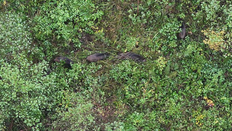
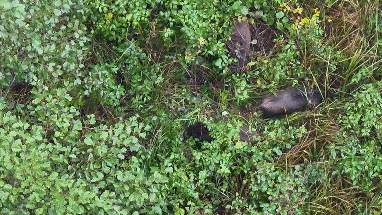
Wild boars are among the most significant wildlife vectors of African Swine Fever (ASF), a highly contagious viral disease that poses serious risks to both wildlife populations and domestic pig farming across Europe. Understanding where wild boars are, how many there are, and how they move through forested landscapes is essential for managing disease transmission and implementing effective prevention strategies.
Within the ICAERUS project, the Forestry and Biodiversity Use Case addresses this challenge through a dedicated Wild Boar Monitoring scenario. By deploying a UAV equipped with a thermal imaging camera, the workflow enables efficient, large-scale surveys of forested areas, providing the population data needed to support wildlife management and reduce ASF transmission risks.
Beta Via contributes expertise in UAV data acquisition, thermal imaging, computer science and geospatial analysis to advance this automated approach to wildlife monitoring.
Thermal Imaging: Detection Where Cameras Cannot See
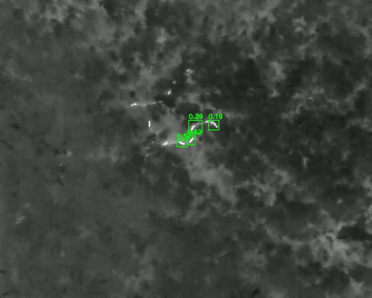
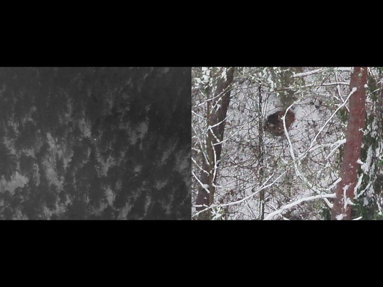
The UAV is equipped with a thermal imaging camera, which detects heat emitted by animals rather than relying on visible light. This makes thermal sensing particularly effective in conditions where standard optical cameras fail: dense forest canopy, low-light environments, and the hours around dawn and dusk when wild boars are most active.
By enabling reliable detection of animals even through thick vegetation and in poor lighting conditions, thermal imaging opens up monitoring windows that would otherwise be inaccessible. This is critical for accurate population assessment, as surveys conducted only during daylight hours or in open terrain would systematically undercount animals in densely vegetated habitats.
From Raw Thermal Data to Automated Counts
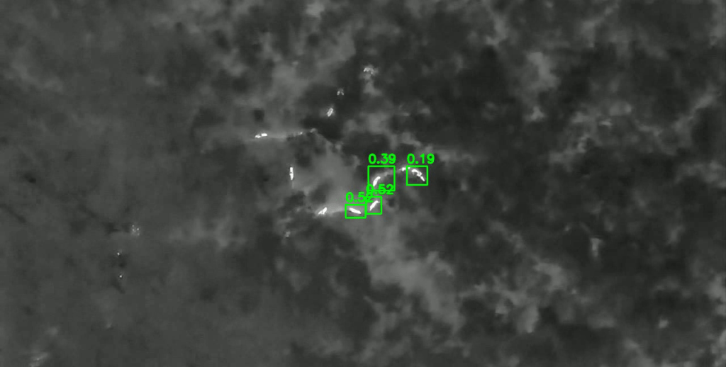
Thermal imagery collected during UAV surveys is processed through a dedicated analytical pipeline. Advanced data filtering and processing methods are applied to remove noise, correct for environmental interference, and prepare the data for analysis. Machine learning (ML) algorithms then take over, carrying out object recognition and automated counting of wild boars identified in the imagery.
The system is designed to identify and classify animals automatically, reducing the need for manual review and enabling the processing of large volumes of aerial data efficiently. The development of these object recognition and counting models is a core technical objective of the scenario, with ongoing refinement to improve detection accuracy across varying field conditions.
The result is a streamlined workflow that moves from raw thermal data to actionable population counts without requiring labour-intensive manual interpretation at each step.
A Digital Library of Thermal Signatures
A dedicated digital library of wildlife thermal signatures is being developed as part of this scenario. The collection includes thermal imagery of wild boars, as well as bisons and deer, captured under a wide range of environmental conditions, different seasons, ambient temperatures, vegetation densities, and habitat types. These additional species were intentionally included to improve model precision and ensure that the detection algorithm can reliably distinguish wild boars from other large mammals commonly encountered in forest environments.
The inclusion of multiple wildlife species strengthens the model’s ability to correctly distinguish wild boars from other large mammals commonly present in forest environments. This broader thermal signature base enhances classification precision and reduces confusion between species. In addition, the library creates a foundation for future automated wildlife‑monitoring applications using drones and thermal cameras, such as population estimation or multi‑species activity mapping.
All thermal datasets are openly published in the ICAERUS Zenodo repositories, ensuring transparency and long‑term accessibility. The automated detection models, training scripts, and processing workflows are available in the ICAERUS GitHub repositories, supporting reproducibility, community use, and future development.
Supporting Wildlife Management and ASF Prevention
The outcome of the Wild Boar Monitoring scenario is a scalable, automated wildlife monitoring system that serves two interconnected purposes: supporting biodiversity management and contributing to African Swine Fever prevention.
By generating accurate population estimates and spatial distribution maps, the system gives wildlife managers and public health authorities the information they need to understand wild boar dynamics in forest ecosystems. This supports targeted interventions aimed at reducing disease transmission risks and managing population pressure in high-risk areas.
The broader ambition of the scenario is to demonstrate how UAV thermal imaging, combined with advanced data processing and machine learning, can deliver a reliable and scalable monitoring capability – one that can be applied across different forest landscapes and adapted to evolving management needs.